
The Beehive, Maplebeck, and east of the branch
 Scan for route GPX
Length: 10.2km (6.6 miles) - Ascent: 99m (325ft)
Terrain: Sections of quiet road, well-made tracks and bridleways, footpath, woodland.
Map: Explorer270/271
Address: Main Street, Maplebeck, NG22 0BS.
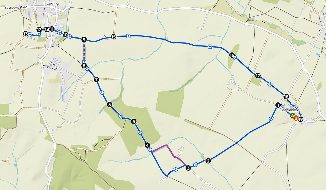
From the Beehive (A), head northwest along Main Street, then just as the road turns to the right, veer left and follow the fingerpost over the stile (1). Follow the obvious path across the field, through the hedge and across the next field. At the end of the field, the path turns right and left (2) before crossing another field. When you arrive at the lane, turn right (3). At this point, I couldn’t take the intended next left, so I had to keep straight on (purple on the map, and drawn on a sign at the entrance to the farm). The temporary path takes the left fork at the entrance to the next field and skirts the left edge of the field before turning left at the far corner and following the left edge of the next field. The intended path is soon picked back up, where you turn right to cross the field, then the bridge, into Dilliner Wood (4). Follow the one obvious path through the wood until you come to a split in the path, with a fence in front of you (5). Take the right fork and proceed through the gate in front of you, past the signs and onto Mansey Common. Again, follow the one path northwest through the common until arriving at a bridge over a brook (6). Cross the bridge and proceed up the steps and into the field. Cross the field (I was guided by the tractor tracks) to the small bridge opposite (7) and then across the next field, again following the tractor tracks. Once at the track (8), turn right, then left and follow it up the hill until you arrive at a small bridge (9). (This last section wasn’t on my mapping and appears to have changed for the installation of the pylons, and is marked as a dotted line on the map. At this point, turning right takes you back towards Maplebeck, and left to Eakring and Mompesson’s memorial. Turn left (it appears you can be on either side of the hedge here) and follow it to the end, before turning right, then left and going down the steps and over the bridge (10). Follow the path up by the park, along the road to the end, then cross Kirklington Road and follow the footpath alongside Jasmine Cottage (11). At the end of the path, take the next one opposite left and continue beside the allotment to the end (12). Take the left path along the horse field, then first right with another horse field now on your left. At the end of the path, you’ll arrive at a lane and the memorial (13). Now retrace your steps back to point (9) before continuing east along the path. You’ll cross another field (15), again using the tractor-made tracks, then along obvious paths, through one small copse (16), and beside another (17) until you reach The Hollows (18). Cross the road and take the path which will soon alight on Church Lane, then turn left and follow the road to the church, where you can turn right to the Beehive (B)